Directions:
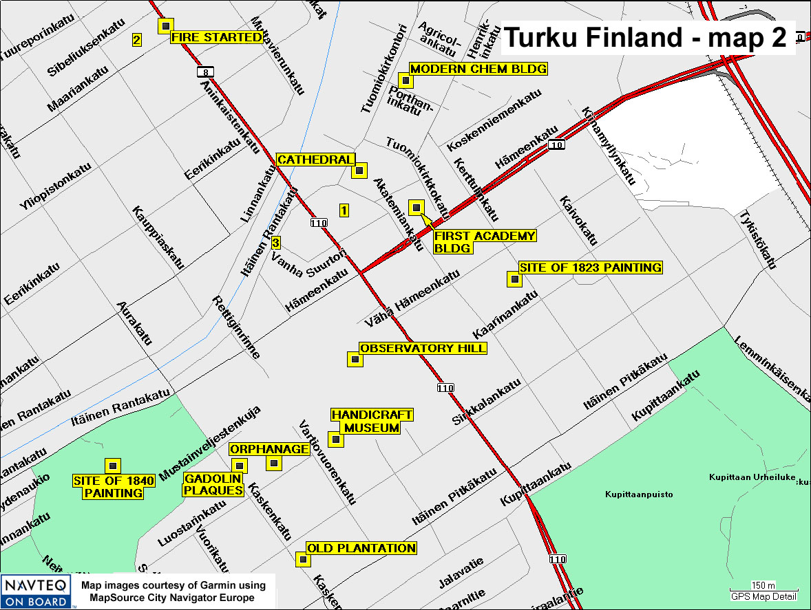
Sites identified in this expanded map are:
Gadolin plaques, on wall in front of fish restaurant, Kalaravintola Kaskenahde,
which was the site of Gadolin's former home, 6A, Kaskenkatu - N60 26.80 E22
16.37
Orphanage in back of fish restaurant, site of Gadolin's laboratory, 5 Luostarinkatu
- N60 26.80 E22 16.46
"Old plantation," where Gadolin raised his crops, now the site of
Surutoin restaurant, where former "Gadolin dishes" were served, Kaskenkatu
12 - N60 26.69 E22 16.51
Turku Cathedral - N60 27.15 E22 16.66
First Academy Building, now occupied by Vanha Akatemiatalo (Old Academy Building)
- Rothoviuksenkatu 2 - N60 27.11 E22 16.77
"1" = Brahepuisto Park, location of Brahe statue - N60 27.1
E22 16.62
Modern chemistry building, "Gadolinia," Porthanskatu (Porthansgatan)
3, - N60 27.25 E22 16.77
"2" = Center of Puutori square, historically a public toilet,
now a restaurant Puutorin Vessa ("Public Toilet Pub") - N60 27.30
E22 16.12
Origin of devastating 1827 fire, Puutori (square), plaque at Aninkaisenkatu
9, on the sidewalk - N60 27.32 E22 16.20
Observatory Hill - N60 26.92 E22 16.65
Handicraft Museum - N60 26.83 E22 16.60
"3" = Approximate location of the postcard of the fire