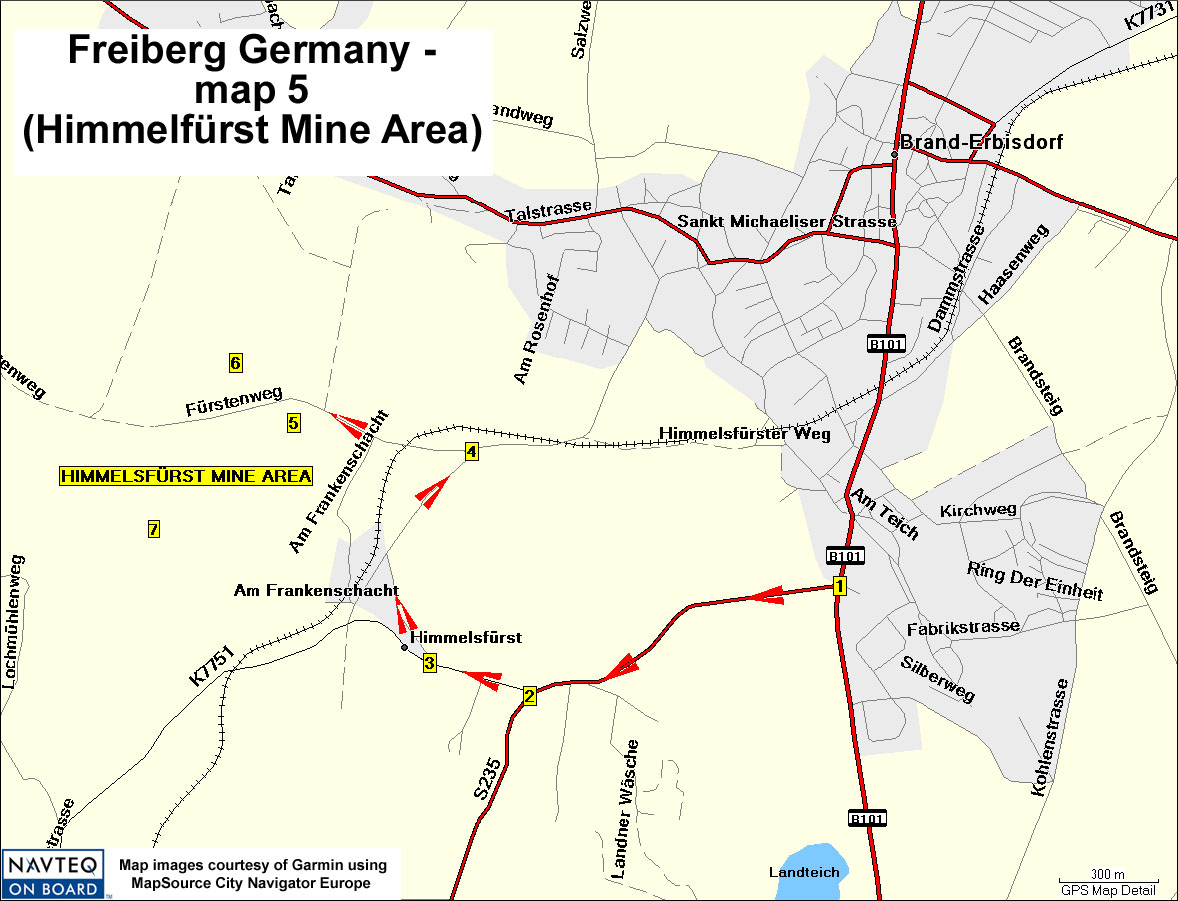
Directions:
This map shows the route to the Himmelfürst Mine area,
which has been closed down with all mines blocked.
"1" = Intersection from Highway B101, where one turns west on Langenauer
Straße toward the Himmelfürst area - N50 51.48 E13 19.17
"2" = After driving 1.0 km west on Langenauer Straße, turn right
on Am Huthaus - N50 51.30 E13 18.38
"3" = intersection - N50 51.38 E13 18.12
"4" = intersection - N50 51.71 E13 18.25
"5" = Fürstenschacht plaque - N50 51.74 E13 17.77
"6" = Bärschacht plaque - N50 51.84 E13 17.62
"7" = Old mine area - N50 51.57 E13 17.40